
Mount Vernon ZIP Directory Areas
Two verified ZIP codes serve Mount Vernon: 98273 and 98274. They are postal delivery areas, not legal city boundaries. Census ZCTAs approximate those areas for statistics, while the Assessor and city use parcel and jurisdiction lines. USPS remains the authority for the code assigned to a deliverable address.
| ZIP Code | Areas Covered | Post Office | Notes |
|---|---|---|---|
| 98273 | Mount Vernon and surrounding postal territory | Verify by full address through USPS | Can cross record jurisdictions |
| 98274 | Mount Vernon and surrounding postal territory | Verify by full address through USPS | Can cross record jurisdictions |
No official source in the research verified a local PO-box-only ZIP, unique institutional ZIP, or dated realignment. The safe rule is to check a complete address in the live USPS tool. A ZIP code directory can narrow geography, but cannot identify an occupant.
Verify a Mount Vernon ZIP
The USPS ZIP Code Lookup accepts a street address, city and state, or an existing ZIP. It can return the standardized postal form and ZIP+4. USPS warns that this confirms an address format, not a person or company at that address. That makes it the first postal check, not a people directory.
Compare the result with the county parcel card. An owner mailing ZIP is where notices go; the situs city-state-ZIP describes the land's location. The two can differ without either record being wrong. Record both fields and their dates.
Search Mount Vernon Addresses by ZIP
Skagit County's maintained-address search includes house number, direction, street, type, unit, city, state, and ZIP. Most text fields use begins-with matching. ZIP alone is not enough, so pair it with a street or another address part. A result can lead to the county parcel identifier.
| Field | Behavior | Best use |
|---|---|---|
| Street name | Begins with | Narrow one ZIP to a road |
| City and state | Address text | Check the stated locality |
| ZIP | Needs another field | Separate postal matches |
| Parcel result | County identifier | Move into land records |
The official county address form is shown below with its ZIP field and related address controls.
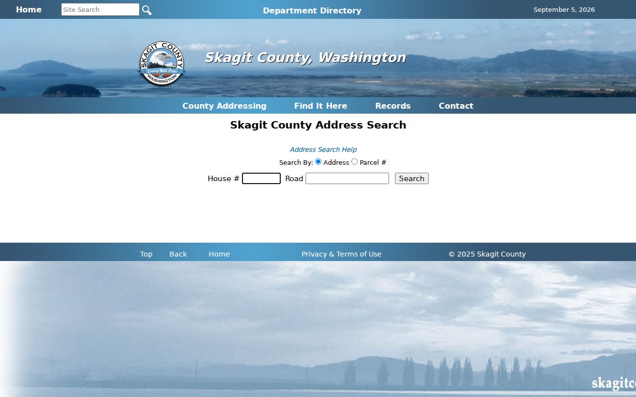
The form makes clear why one more address field is required before searching.
Find Mount Vernon Records by ZIP
The Assessor does not publish a simple roster for 98273 or 98274. It offers address, parcel, owner name, road, and XrefID modes, then shows mailing and situs fields on the parcel card. iMap maps parcels and districts. Together they can confirm land and owner data, but not every resident.
- Verify the full address and ZIP through USPS.
- Search the street or owner in the Skagit County Assessor portal and save the parcel number.
- Open the parcel in iMap to inspect its geometry and public district layers.
- Use a voter-file extract only under Washington's request agreement and statutory limits.
After the ZIP narrows to a road, the Mount Vernon street directory gives the street-level parcel and deed method. Keep each ZIP result tied to its source date because postal routing can change.
Read Mount Vernon ZIP Parcel Fields
The Assessor parcel card separates owner, mailing address, situs address, values, taxes, transfers, permits, and map tabs. The public ArcGIS layer adds owner ZIP, situs city-state-ZIP, legal description, sale information, districts, building details, and PLSS geography. PLSS means section, township, and range in the Public Land Survey System.
A mailing ZIP may belong to an owner who lives elsewhere. A renter or family member may never appear. This is the key myth to avoid: a ZIP, permit, deed, voter status, or parcel owner does not prove every person living at an address.
ZIP check. Compare USPS, situs, mailing, and jurisdiction fields before calling a parcel part of Mount Vernon.
Mount Vernon ZIP Map Accuracy
County Address Management says its 2021-22 aerial and spatial work improved address-point accuracy from about 300 feet to about 13 feet. This can explain a shift between an old GIS point and today's map. It was an accuracy project, not a verified street renumbering or ZIP split.
iMap provides parcel and district context, while Census ZCTAs support broad statistics. Neither replaces the USPS address or the incorporated boundary. Choose the layer that answers the actual question.
ZIP Geography Along the Skagit
The Skagit River and floodplain make precise parcel location useful. City material describes a floodwall designed for 38 feet, and county history records 2021 and 1996 river levels near 37 feet. Flood districts and parcel geography can add property context, but they identify no resident.
Postal codes group delivery points across terrain and jurisdiction lines. For one property, move from ZIP to verified address, parcel, legal description, and public district layers. That path is more reliable than assuming all 98273 or 98274 records belong to one office.
Mount Vernon ZIP Versus City Limits
A ZIP code is a USPS delivery construct. A city limit is a legal municipal boundary. A ZCTA is a Census Bureau approximation for statistics, and a situs address is the parcel's location label. These areas need not match. A Mount Vernon mailing name can therefore occur beyond the city line.
- ZIP vs ZIP+4
- The five-digit delivery area versus four added digits that narrow a delivery segment.
- PO-box ZIP
- A code used mainly or only for post-office boxes; none was verified locally.
- Unique ZIP
- A code assigned to one large recipient; none was verified for Mount Vernon.
- Carrier route
- The smaller group of addresses served on one postal delivery route.
Ask the office that owns the fact. USPS settles postal coding, the city or county settles address authority, the Assessor identifies the parcel, and Census defines the ZCTA. That source ladder keeps the ZIP code directory accurate.